Monitoring
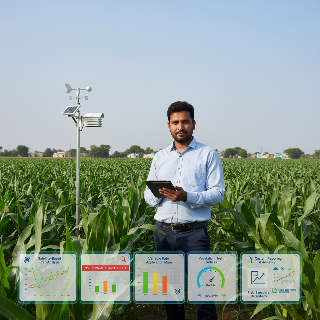
Crop Monitoring
Satellite-Based Crop Analysis: Leverage Sentinel and high-resolution satellite data for field health insights, growth monitoring, and stress detection.
AI Disease Forecasting: Use machine learning and environmental data to predict and prevent crop diseases.
Variable Rate Application (VRA) Maps: Generate precise input prescriptions for seeding, fertilization, and irrigation.
Vegetation Health Indices: Offer NDVI, NDMI, and custom indices for real-time assessment of crop vigor, moisture, and biomass.
Field Boundary Detection: Automatically delineate and monitor field perimeters to support accurate mapping and analytics.
Weather Data Integration: Aggregate live weather data to inform farm operations and support risk management decisions.
Custom Reporting & Advisory: Access analytical reports and consult with expert agronomists.
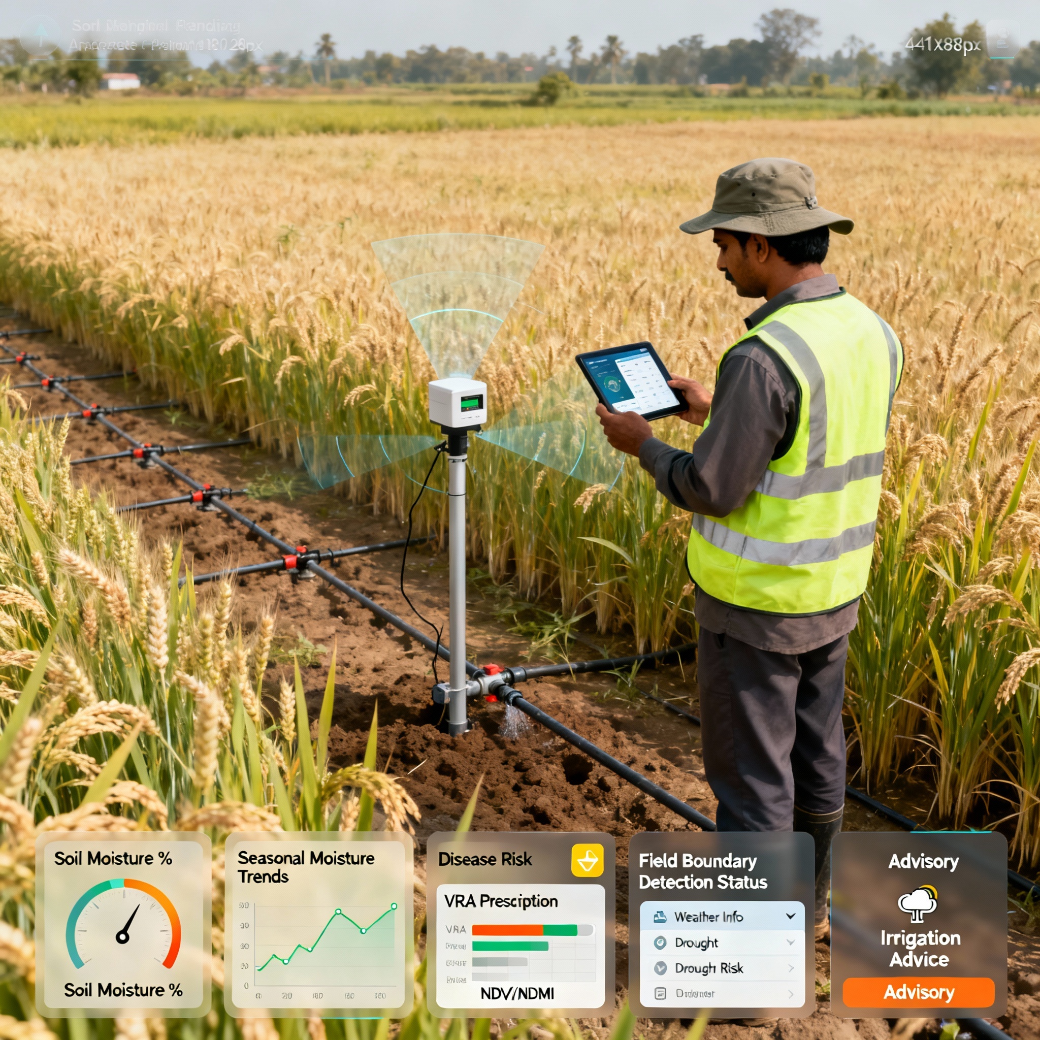
Soil Monitoring
Satellite-Derived Soil Moisture Estimation: Utilize passive and active microwave sensors (Sentinel-1 SAR, SMAP, SMOS satellites) to estimate surface and root-zone soil moisture dynamically.
Ground Sensor Data Integration: Combine satellite data with in-field sensor networks for accurate calibration and validation.
Spatial Soil Moisture Mapping: Provide detailed soil moisture distribution maps at field or regional scale to guide irrigation scheduling.
Drought Risk and Water Stress Indicators: Detect early signs of drought conditions via soil moisture anomalies integrated with weather data.
Irrigation Optimization Recommendations: Help schedule irrigation to minimize water waste and maximize crop health based on precise soil moisture status.
Seasonal Soil Moisture Trends: Assist in analyzing soil moisture history to plan crop rotations, soil amendments, and water resource management.
Custom Alerts & Thresholds: Notify users of critical low/high moisture conditions via dashboards or mobile alerts.
Support for Water Resource Planning: Deliver aggregated data supporting sustainable groundwater and surface water management
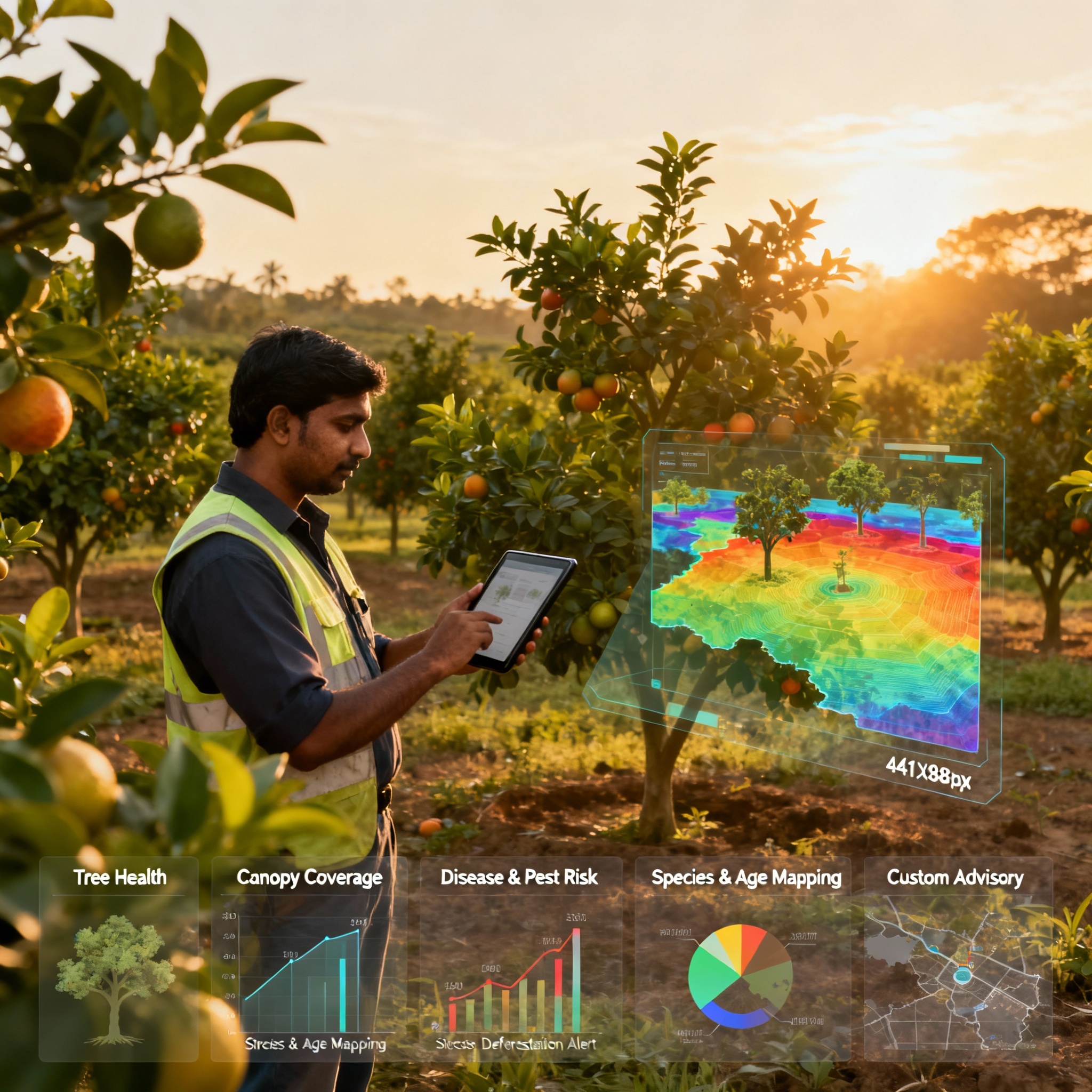
Trees Monitoring
Satellite-Based Tree Health Monitoring: Use multispectral and hyperspectral satellite data (Sentinel-2, PlanetScope) to assess tree vigor, chlorophyll content, and detect early signs of disease or pest infestation.
Growth and Canopy Coverage Analysis: Track canopy expansion, growth stages, and biomass accumulation using time-series satellite imagery.
AI-Powered Disease and Pest Forecasting: Leverage AI models trained on environmental and imaging data to predict outbreaks of common tree diseases and pests such as fungal infections or beetle infestations.
Stress Detection: Detect water stress, nutrient deficiencies, or heat stress in orchard or forest trees via vegetation indices like NDVI, Red Edge NDVI, and PRI (Photochemical Reflectance Index).
Tree Species Classification & Age Estimation: Utilize remote sensing classification algorithms to map tree species diversity and estimate tree ages beneficial for managed forestry or orchards.
Deforestation & Illegal Logging Alerts: Monitor changes in tree cover to provide early warnings of deforestation or unauthorized harvesting activities.
Custom Reporting & Advisory: Generate health status reports, provide recommendations for fertilization, irrigation, and pest control tailored to orchard or forestry management.
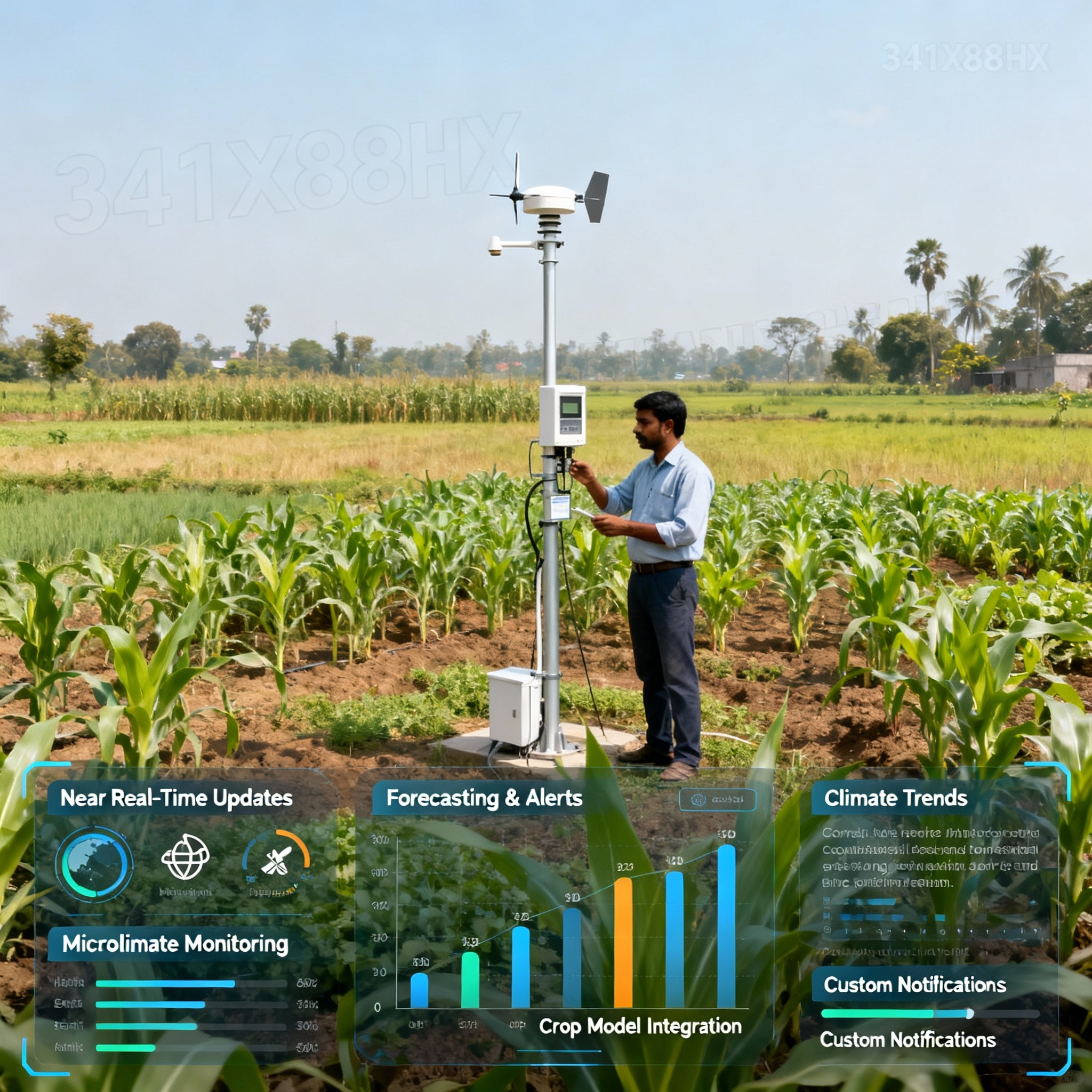
Weather Monitoring
Near Real-Time Weather Updates: Provide instant access to temperature, precipitation, humidity, wind speed/direction, solar radiation, and frost alerts.
Forecasting & Alerts: Offer short- and long-term weather forecasts with probabilistic models; issue alerts for extreme weather events like frost, hail, drought, or storms impacting crops.
Microclimate & Field-Specific Weather Monitoring: Use localized weather data combined with satellite-derived parameters for hyperlocal weather insights affecting specific fields or plantations.
Climate Trends & Historical Weather Analysis: Retrieve and analyze historical climate data to inform planting schedules and strategic planning.
Integration with Crop Models: Use weather data inputs to fine-tune disease forecasting, irrigation scheduling, and yield prediction models.
Customizable Notifications: Allow users to set threshold-based alerts (e.g., heatwaves, rainfall volumes) via app, SMS, or email.
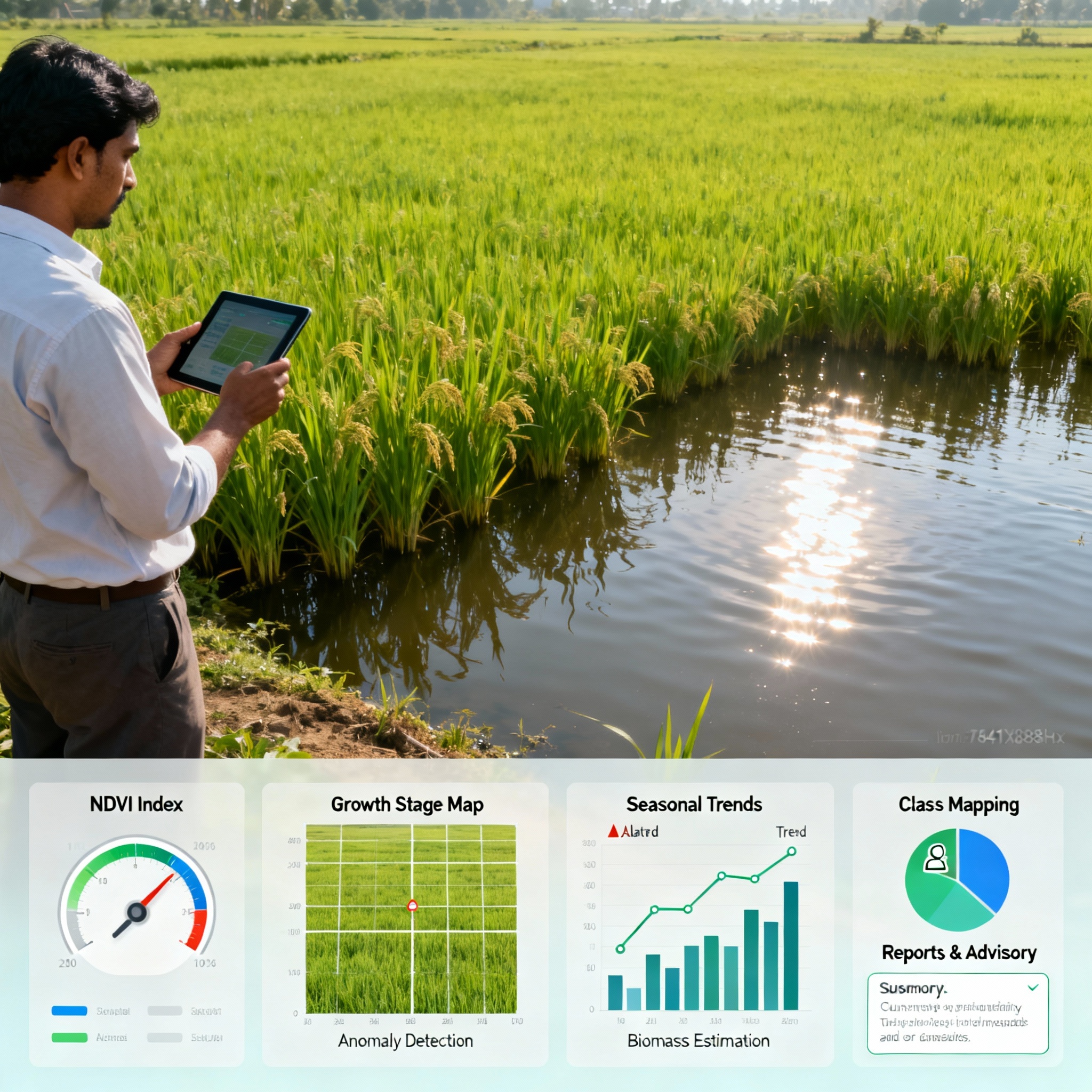
Vegitation Monitoring
Vegetation Indices Computation: Calculate and deliver common indices such as NDVI, EVI, SAVI, NDWI, and custom indices to measure plant health, biomass, chlorophyll content, and canopy water content.
Crop Vigor & Growth Stage Mapping: Provide detailed maps to track crop phenology, vigor variations, and stress conditions across fields or landscapes.
Stress and Anomaly Detection: Use satellite and drone imagery to detect pest infestation, nutrient deficiencies, drought stress, or disease onset before they are visually evident.
Season-Long Vegetation Dynamics: Analyze time-series data for growth trends, enabling more accurate crop condition tracking and harvest timing.
Biomass & Carbon Stock Estimation: Support carbon market participation by estimating biomass accumulation and carbon sequestration from vegetation cover.
Multi-Vegetation Class Mapping: Differentiate among crop types, weed infestations, or natural vegetation for precise management.
Custom Reports & Decision Support: Provide actionable insights through user-friendly dashboards and advisory reports, including recommendations for interventions.
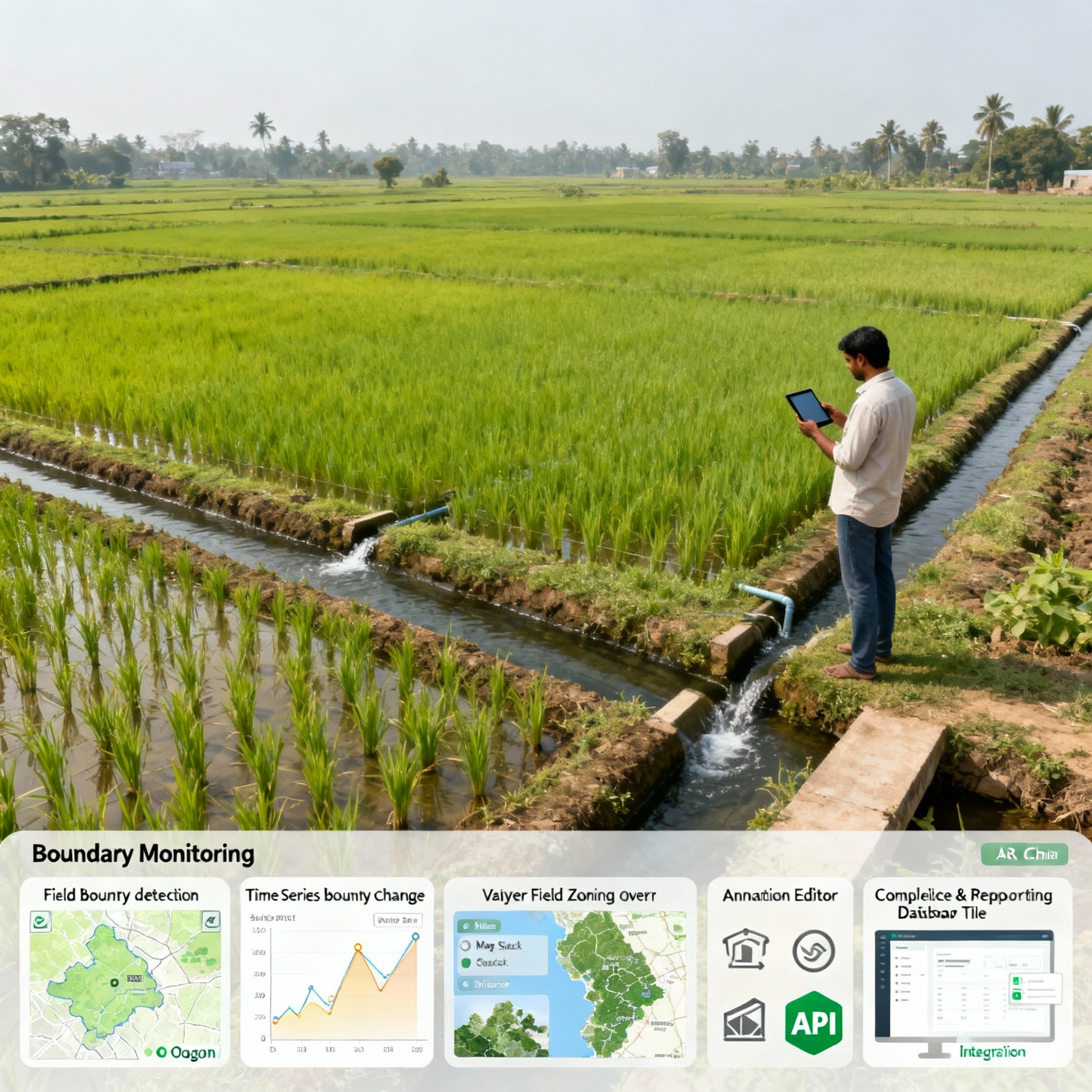
Boundary Monitoring
Automatic Field Boundary Detection & Digitization: Use computer vision and deep learning on high-res satellite or drone imagery to delineate field and plot boundaries accurately, even for irregular shapes.
Change Detection & Boundary Updates: Track temporal changes in field or forest boundaries, detect encroachment, land use change, or field fragmentation.
Boundary Validation & Integration: Compare satellite-derived boundaries with cadastral maps, land registry data, and existing GIS layers for consistency.
Multi-Layer Field Mapping: Provide overlays of management zones, crop rotations, irrigation blocks, and soil types within boundaries.
User Editing & Annotation Tools: Allow users to manually adjust boundaries and add metadata for precision farm management.
Compliance & Reporting: Support regulatory compliance by generating detailed maps required for subsidies, insurance claims, or certification audits.
API Access for GIS Integration: Enable seamless integration with farm machinery and third-party GIS/ERP platforms.